Do urban design interventions in informal settlements reduce levels of crime in low income areas?
Medellin, Colombia
It is important to analyze the historic dynamics of violence within the city of Medellin to understand the complexity of the conflict and its relationship with its current social and physical segregation. The exclusion of vulnerable groups from society reduced the access to better opportunities for underprivileged communities to improve their current precarious conditions. The absence of a strong governmental authority has created encouraged illegal organizations to legitimize their power and supplant the State’s role by controlling the supply of basic services such as education, health and housing. There is a constant conflict between the State and other illegal authorities within the communities to control and take ownership of governmental resources, which perpetuates the cycle of violence.
In 2004, local authorities began the construction of Integral Urban Projects (IUP) in boroughs One and Two, located in northeastern Medellin. The IUP strategy was to intervene and transform outdated public spaces and educational institutions. The main objective was to create a social regeneration process by improving the physical environment of these segregated communities.
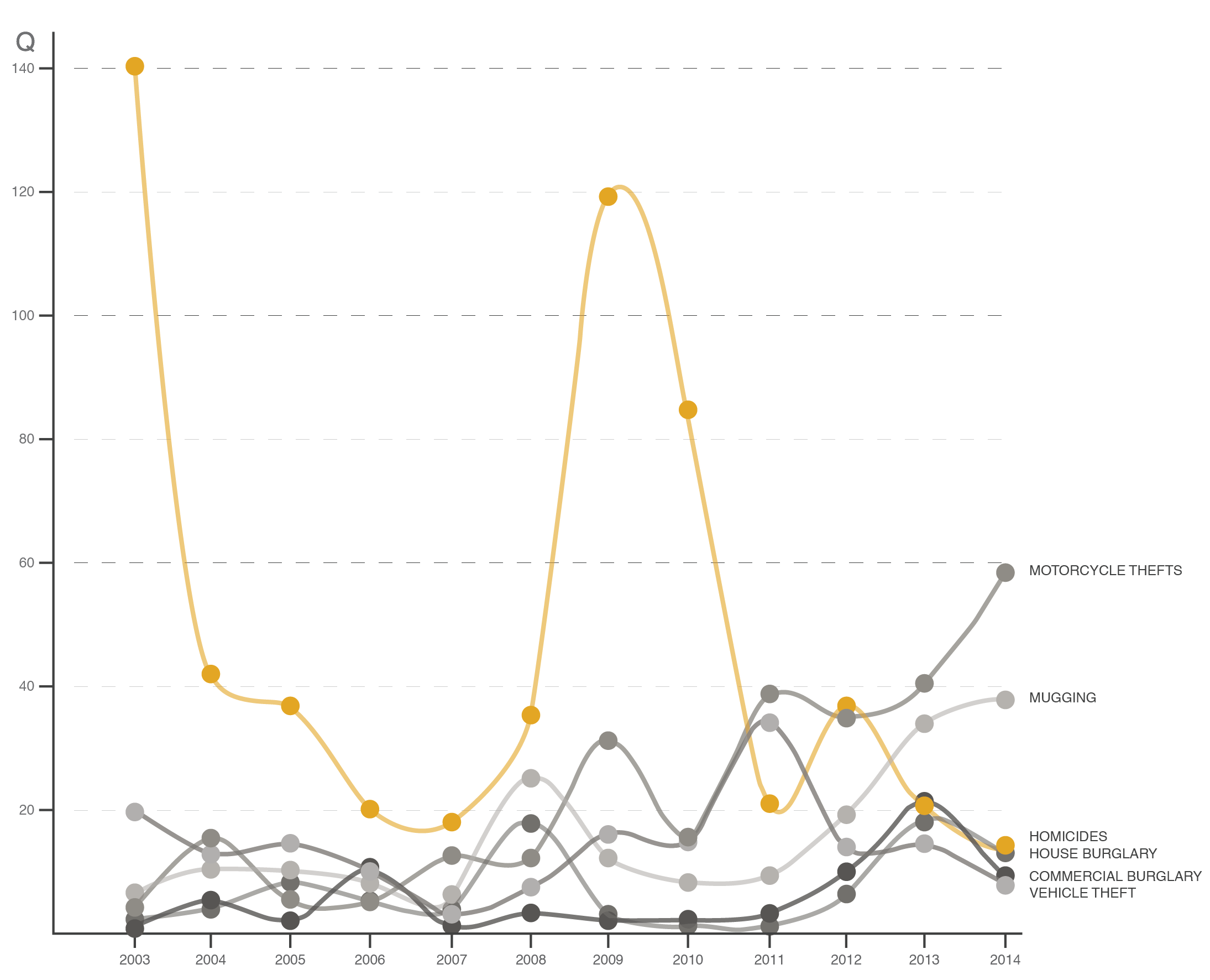
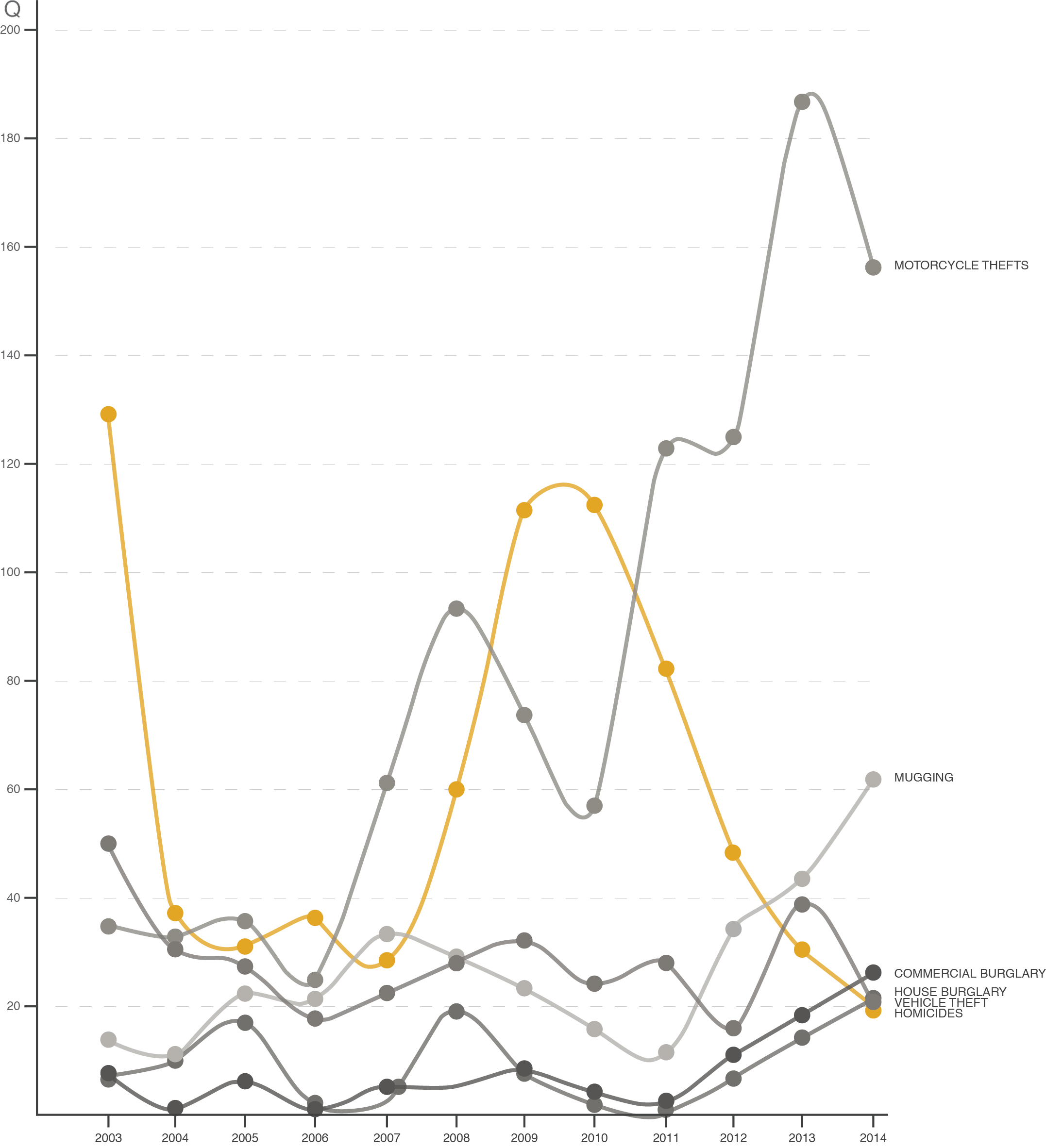
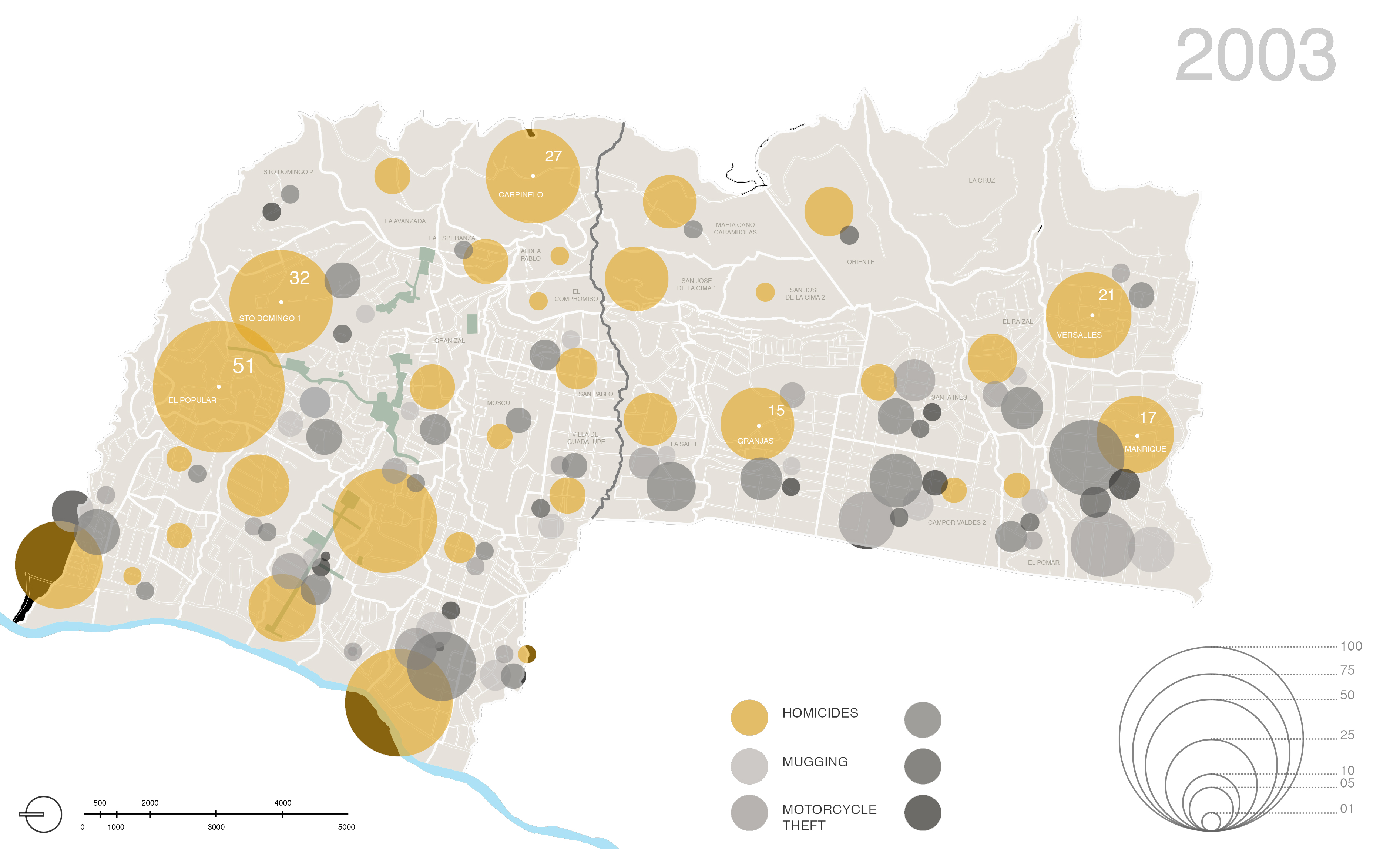
This project was seeking to learn if the IUPs helped in the reduction of violence in high conflict areas. Based on data collected by the Medellin National Police, the team was able to generate a geographic map to highlight the historical variations on the rates of violence for boroughs One and Two before and after the implementation of the IUPs. These findings were also compared with borough Three, which had no IUPs implementations. Borough Three served as a control group since these communes had similar characteristics in population, socio-economic levels and deterioration of the public space.
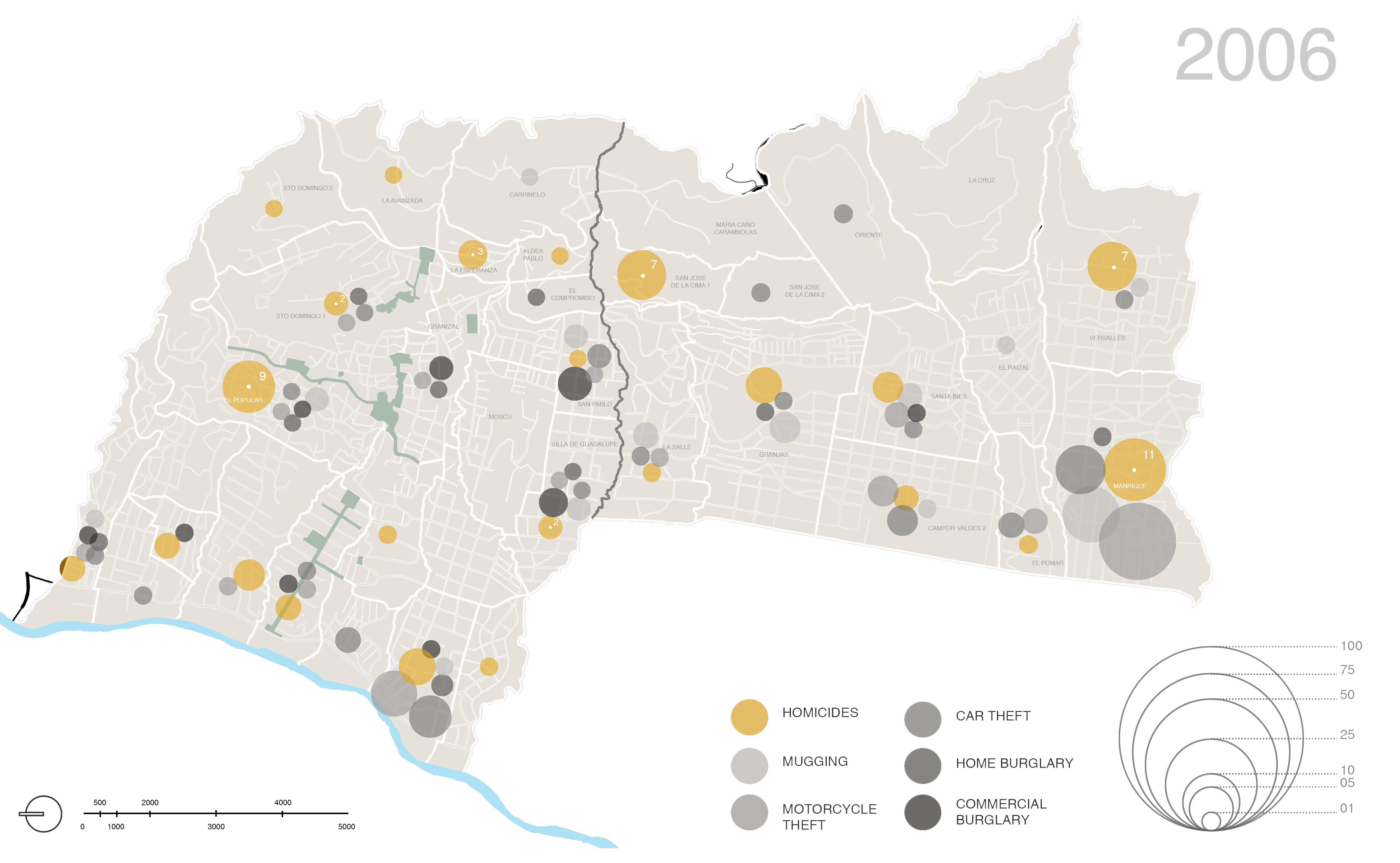
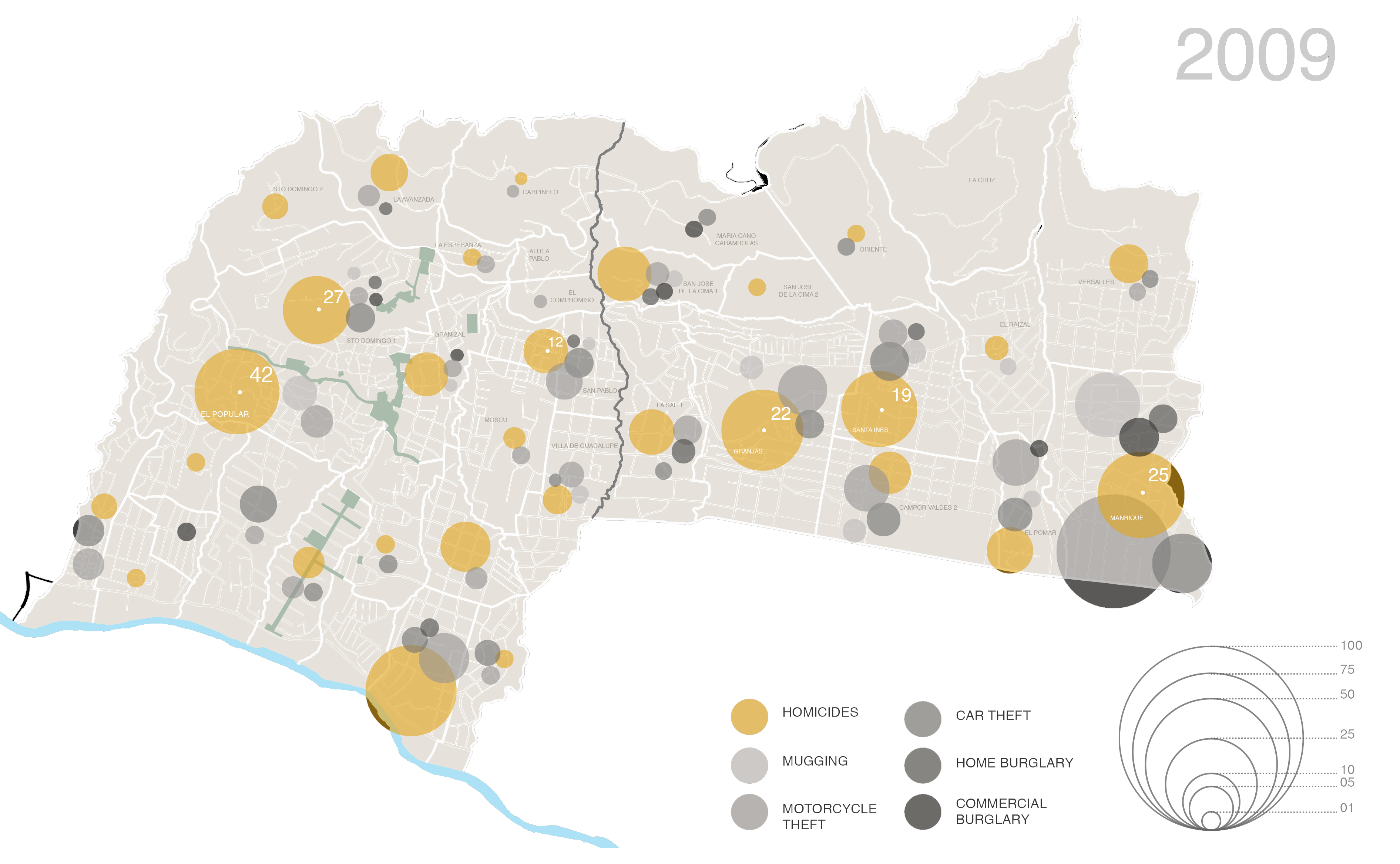
The intention of this project is to show how data could be implemented to analyze the impact of public policies in the urban context to refute or reaffirm urban projects, concepts or policies.